 |
Cerdded Cymru - The Welsh Walks Guide
|
Walks around Ponterwyd - Google Maps

List of Walks
Ascending Pumlumon from Dyffryn Castell (8 miles)George Borrow Hotel to Llyn yr Oerfa, Ystumtuen and Bryn Bras (5 miles)
The George Borrow Hotel to Parsons Bridge, Ysbyty Cynfyn and the round hills beyond. (6 miles)
|
Ascending Pumlumon from Dyffryn Castell (8 miles)
|
Walk type:
Upland moorland Distance: 8 miles 13 km (approx) Walk grade: A |
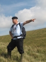
View photograph(s) of route:
|
| View route on map | ||
| At 752 metres (2483 ft approx) above sea level Pumlumon is the highest mountain in Mid Wales, between the Brecon Beacons in the south and Cader Idris to the north. This route from Dyffryn Castell is probably the pleasantest way up to the Pumlumon summit. A reasonably gradual climb most of the way, other for a steep climb at an early stage, but with some pleasing contour stretches. It is the route George Borrow is said to have taken. The route mostly follows fences or woodland edges which make it easy to navigate. | Starting place:
The route starts form the disused Dyffryn Castell Hotel on the A44 road between Llangurig and Aberystwyth. The start point is about two miles on the Llangurig side of Ponterwyd.
Map reference: SN775817 Parking: Parking place: The Dyffryn Castell hotel has been out of use for many years so there are likely to be no objections to you parking in the car park opposite. Otherwise there is a car park at the road junction a few hundred metres at the road junction a few hundred metres in the Aberystwyth direction. Negotiating the main road to the start point is quite dangerous from this alternative car park and not recommended. | |
|
George Borrow Hotel to Llyn yr Oerfa, Ystumtuen and Bryn Bras (5 miles)
|
Walk type:
Upland moorland Distance: 5 miles 8 km (approx) Walk grade: C+ |
View photograph(s) of route: |
| View route on map | ||
| A walk over moorland and green fields starting and finishing at the George Borrow Hotel, Ponterwyd. | Starting place:
George Borrow Hotel, Ponterwyd
Map reference: SN746558 Parking: Park in village or if refreshments are to be sought then ask at the Hotel | |

|
The George Borrow Hotel to Parsons Bridge, Ysbyty Cynfyn and the round hills beyond. (6 miles)
|
Walk type:
Hills and forest Distance: 6 miles 10 km (approx) Walk grade: B |
View photograph(s) of route: |
| View route on map | ||
| Traverses National Trust land, moorland and Forest Enterprise land and crosses the well known Parson�s Bridge over the Rheidol river. | Starting place:
George Borrow Hotel at Ponerwyd, 11 miles east of Aberystwyth on the A44. Public toilets by A44 near river bridge.
Map reference: SN746543 Parking: Possible parkingnear the play area, on the left a few yards up the Devils Bridge Road. | |
